![]()
|
Index
•
|
|
Welcome
•
|
|
21st Century•
The Future |
|
World
Travel•
Destinations |
|
Reviews•
Books & Film |
|
Dreamscapes•
Original Fiction |
|
Opinion
& Lifestyle •
Politics & Living |
|
Film
Space •
Movies in depth |
|
Kid's
Books •
Reviews & stories |
|
|
|
|
The International Writers Magazine: USA Road Trips
Discussing the geographic portion of Kentucky considered "southwest" is like the observing same portion of the US states of Maryland or Vermont. It is a very narrow area where the northwest corner is�hardly two�dozen miles from the southwestern area of the state.
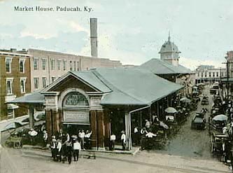
Paducah
• Ari Kaufman
On a balmy but windy early February Saturday, my fiancée and I eschewed our plan to take a 16 hour round trip weekend drive to Lawrence, Kansas, to see my beloved Kansas Univ. Jayhawks play basketball, and instead drove 220 miles each way on a whim from her home in Western Indiana down to Paducah, in Kentucky’s southwest corner.I'd honestly say this is clearly one of my five or six favorite small cities in America now, joining Morgantown (WV), Lexington (VA), Chattanooga (TN), Lawrenceburg (IN) and perhaps Frederick (MD). From the history to the architecture, people, antiques, Ohio and Tennessee River confluence, inexpensive food and drink, layout, surrounding hills, murals of city history, historic homes and monuments, it, like this region of America often deemed the Missouri Valley, was FANTASTIC. I'd move there in a heartbeat, for this is America at its most authentic. And I am a coastal suburban kid saying this. I woke up a few years back.
To share more details, mundane to some yet fascinating to others:
Paducah is the largest city in Kentucky's Jackson Purchase Region---the far west region of the state that was still Indian territory when Kentucky became a Commonwealth (15th state overall) in 1792 after enough Virginians migrated there---and, more importantly, is strategically located at the confluence of the Tennessee and Ohio River. The population is roughly 25,000. Twenty blocks of Downtown Paducah have been placed on the National Register of Historic Places.Paducah began around 1815 as a mixed community of American Indians and white settlers who were attracted, naturally, by its location at the confluence of many waterways.
Legend notes that Chief Paduke, a Chickasaw Indian, welcomed the people traveling down the Ohio and Tennessee on flatboats. The settlers appreciated his hospitality and settled across the creek. The two communities lived in harmony trading goods and, like in many locales this time, enjoyed each other's culture.
In 1827, 35 years after Kentucky had become its own state, William Clark, leader of the Lewis and Clark Expedition and superintendent of Indian affairs for the Mississippi-Missouri River region, arrived, and asked both the Chief and the settlers to move along. They did so, offering little resistance since the deed was issued by the United States Supreme Court and carried with it the full authority of the U. S. Government backed by the United States Army. It was as fair as one could have imagined. No violence ensued.
The amicable relations continued, as relayed here:
Clark surveyed his new property and laid out the grid for a new town which remains evident to this day. The Chief and his villagers moved to Mississippi allowing Clark to continue with the building of the new city which he named Paducah in honor of the Chief. Upon completion of the platt, Clark sent envoys to Mississippi to invite Chief Paduke back to a ribbon-cutting ceremony but he died of malaria in the boat while making the return trip. The settlers had been allowed to purchase tracts within the new grid but most of them moved on to less developed areas.
Paducah was incorporated as a town in 1830, and quickly continued to be a town of utmost importance.
Because of the waterways, it offered valuable port facilities for the steam boats that traversed the river system. A factory for making red bricks, and a Foundry for making rail and locomotive components became the nucleus of a thriving River and Rail industrial economy.
Paducah was chartered as a city in 1856, and henceforth became an important railway hub for the Illinois Central Railroad, the primary north-south railway connecting Chicago and St. Louis to the Gulf of Mexico in Mississippi.Some of the city’s most intriguing history came during the Civil War.
Late in 1861, Union General Ulysses S. Grant captured Paducah, which gave the Union control of the mouth of the Tennessee River. Throughout the rest of the war, massive Union supply depots and dock facilities for the gunboats that supported Federal forces along the Ohio, Mississippi and Tennessee River systems were located at Paducah.
The one black eye during this time came on December 17, 1862 when under the terms of General Order No. 11, thirty Jewish families were forced from their home, until a prominent local Jewish businessman dispatched a telegram to President Lincoln, then met with him and eventually succeeded in getting the order revoked.
On March 25, 1864, Confederate General Nathan Bedford Forrest, a brutal man and future founder of the KKK, raided Paducah to re-supply the Confederate forces in the region with recruits, ammunition, medical supplies and horses among much else. The raid was successful in terms of the re-supply effort and in intimidating the Union, but Forrest eventually returned south.
And most recently, in 1937, during the great Ohio River flood that every Midwesterner knows, water at Paducah rose above its 50-foot flood stage to nearly 61 feet. This forced 27,000 residents to flee to higher ground. Shelters were provided by the American Red Cross and local churches, and buildings we saw in downtown still bear plaques that highlight the high water marks.
Nearly 20 inches fell during those two brutal weeks, making the Flood of '37 the worst natural disaster in Paducah's history. The United States Army Corps of Engineers was commissioned to build the flood wall that now protects the city from the ravages of flooding.
As for us, we strolled through downtown's antique shops, noted the antiquated buildings and large Catholic Church at street's end, and basically enjoyed the serenity of a peaceful Sunday in a revitalized downtown that still has some work to complete, but is doing quite well. I would not expect most of my other friends to understand why, to me, this was far more appealing than Paris, San Francisco or Miami.
After a nice southern dinner, we enjoyed the sunset over the confluence of the Ohio and Tennessee, gazing at the boats, bike riders (it was in the mid 50s at least), Civil War historic markers and incredible murals that chronologically detail Paducah's proud history and stand adjacent to the Riverfront.
SOUTHERN INDIANA
In mid-March, on an overcast but tolerable day, we trekked a few hours south on country roads to the southwestern portion of the Hoosier State for a traipse through some unique land. Bordering the Ohio River and “German Catholic land” Jasper. Jasper does indeed have quite the German influence. For one things, it is an immaculate town, with a pristine courthouse, adorned with a great Civil War Memorial that denotes the four great battles of the War Between the States: Gettysburg, Antietam, Chickamauga and Shiloh. By my quick military historian math, more than 130,000 deaths resulted from the nine days of war of those bloody yet decisive battles. Gives one quite the perspective, eh?
In any event, legend has it, and facts support it, that the state of Indiana's German population migrated to the new world along religious and geographic lines. That is to say that the Northern Germans, mainly Protestant in affiliation, inundated the Northern portion of Indiana throughout the 19th and 20th centuries, due to the flat lay of the land. But as you move south of the Indianapolis and the 40th parallel, the Catholics of Southern Germany settled, enjoying the familiarity of rolling hills and lush forests. For one thing, the churches confirm this. Catholic churches, especially the Gothic German style of Jasper and nearby Huntingburg, look far different than the Baptist, Presbyterian or Methodist styles in other parts of Indiana, especially the northern region.
But as you move east from Dubois County into rural Spencer and Perry County, the area's residents (or at least the founders and antecedents) become Swiss, as confirmed by Tell City, Indiana, named for William Tell, the legendary war hero of the 14th century. His statue sits in front of the City Hall in this modest, neglected town at Indiana's extreme southern edge along the muddy Ohio.
And further back up the road(s), not far from Interstate 64, -which sweeps through the Hoosier National Forest across Indiana's southern edges, linking Saint Louis, MO and Evansville, IN with Louisville and Lexington, KY---is Saint Meinrad's Archabbey, founded by Swiss monks in 1854. Located in Spencer County, which sits between Dubois (Jasper) and Perry, it is one of only two archabbeys in the United States and one of 11 in the world.
These monks came to southern Indiana to assist the needs of the growing German speaking Catholic population---and of course to prepare local men to be priests. Perhaps its most unique feature is that Saint Meinrad operates an international company that produces and markets religious and inspirational cards as well as books and gifts. Abbey Press is one of the largest businesses in the county with more than 200 employees. It began just a dozen or so years after the abbey opened when the monks purchased a used printing press. Today, Abbey Press markets its products throughout the United States and in 25 countries.
While in the Abbey's Gift Shop, my fiancée shopped, and I sat down with "Off the Beaten Path: Indiana" to read about any other sites we could take in before the sun went down. It was nearly 3pm, I had work the next day of course, and we were at least 200 minutes from home, so they had to be conveniently located along the slow road back to Indianapolis.
One was very unique and quite historical. A few miles back up the road from Tell City, is Troy. With a current population of fewer than 400 folks, Troy claims to be Indiana's second oldest city, after Vincennes, which was founded in 1732. As Troy was founded in the 1820s, I'm not sure how accurate this can be, even if they are going by its founding in terms of Indiana as a state, which occurred in 1816. Still it's doubtful.
Along the Ohio River above Troy stands, yes, "Christ of the Ohio." It is in fact a 20 foot statue of Jesus, which looks south toward Kentucky and apparently is lit up at night so folks can see it from the river if necessary. There is only one sign leading visitors to it, and it's hard to spot, but the guide book gave me directions. You go up a muddy hill, then park on the road and walk up another hill about 300 feet to a spot where the statue is with a great view of the scenic byway, river and Kentucky hills below.
The story, as I read on the internet the next day, is even more intriguing. Located in a mostly unknown spot and not well marked, it was completed in 1956 by a "repentant" German who had been a POW during the Second World War. A Father at Saint Meinrad requested this German, then in an English prison but also apparently an artist, to come to Indiana. The reason?
As the story goes, in the artist's own words:
"He {Father Paul} told me of a wealthy doctor and his mother who lived in a place called Tell City, Indiana. The doctor lived on a high hill overlooking the Ohio River and wanted something sculpted that would give travelers inspiration on their journeys on the river. I saw this not only a challenge, but also a chance to keep my promise. "Yes! Yes!" I screamed into the receiver. I heard the words of my prayer crying out in my mind. "I will do something for you Lord." This statue IS my "something".
The last stop was also moving, but in a more melancholy way.
Forty-eight years ago to the very day that we traversed the bare, windy hills of southwestern Indiana above and along the Ohio River, there was a airline tragedy. Nearly twenty-thousand feet up in the air, the Northwest Airlines lectra jet, heading from Minneapolis to Miami, simply broke apart and tumbled to earth, killing all 63 passengers and crew on board. The impact left a crater in the earth that was 20 feet deep and 30 feet wide.
It is now a humbling but eerie site. Located on a desolate road a few miles from the main road (which, though it's the Ohio Scenic River bi-way, is pretty rural), the memorial is simple yet powerful.
The citizens of Perry County and the Cannelton Kiwanis Club raised funds for a memorial at the site of the crash. Dedicated less than a year later, the Kiwanis Electra Memorial marks the site. The inscription reads:
"This memorial, dedicated to the memory of 63 persons who died in an airplane crash at this location, March 17, 1960, was erected by public subscription in the hope that such tragedies will be eliminated."
Quite moving, and we reflected upon this on the long road west and then north back to Central Indiana.
© Ari Kaufman April 2008
ajkauf7@yahoo.com
Place to Stay in Paducah: http://www.kyquiltretreat.com/home.htm
Penn Station
Ari Kaufman
Steel City Renaissance
Ari Kaufman in Pittsburgh
Bushkill Falls
Ari J Kaufman
Tritowns by Ari Kaufman
Crossing America to find the 'Field of Dreams'
Bogota
Ari J Kaufman
The Natchez Trail
Ari J Kaufman
One Fine Day in the Badlands
Ari j Kaufman
Driving Deep South
Ari Kaufman
Michigan
Ari Kaufman
Indianapolis
Ari Kaufman
You can buy Ari's new book of travels here

More US Travel
Home© Hackwriters 1999-2008
all rights reserved - all comments are the writers' own responsibiltiy - no liability accepted by hackwriters.com or affiliates.