
![]()
Welcome • |
About
Us • |
 The Repossession of Genie Magee Where are the missing teens? |
James Campion Reality Check USA • |
The International Writers Magazine: US Road Journeys Archives
A Stewart County Thanksgiving
• Ari Kaufman drives 1000 miles for dinner
The day before American Thanksgiving, my girlfriend and I set out on a roughly 1,000 mile trek from Terre Haute, Indiana, to her parents home in the northeast Orlando, Florida, suburb of Oviedo. We'd head right back three short days after arrival.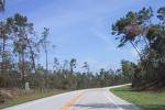
While time was naturally of the essence since the turkey would be served sometime Thursday evening, I had little choice but to do the mundane and pedestrian with our rental car: drive down the way everyone else would, via Interstate. Boredom of the driving variety infiltrated my mind each day preceding the trip, thus I had to make some detours. After all, why drive down if you're just going to see trees, a few hills, fast food places and be stuck sitting in the same traffic as every other Turkey Day traveler?
So, for the first half of Wednesday, I used our point of entry on the western edge of the Hoosier State for a slight detour that would prove to be - thanks to map research - well worth the extra few hours and nominal miles.
Maria and I sailed west a dozen miles into Illinois, then picked up the Eastern portion of the "Lincoln Heritage Trail" (Illinois Highway 1) along the eastern spine of the state, just across the Wabash River from my state of Indiana, cruising southward about 100 miles through three or four cute small towns like Lawrenceville, Mount Carmel and Carmi; the latter is pronounced "Car-my." All this occurred prior to this mostly-languid road entering the Shawnee National Forest, a beautiful enshrinement of the final 20 miles or so of the otherwise dull state of Illinois. (Yeah, I've developed a bit of a "rivalry" with me neighbors to the west since I became a Hoosier.)
The Shawnee National Forest engulfs the entire southern portion of Illinois, hovering over the Ohio River. As we drove through the eastern part of the forest, which was now called the "Southern Portion" of the Lincoln Heritage trail, we didn't pass any Lincoln haunts, but did see immaculate farms, hills, streams and even a penitentiary. Then, as we leveled off, approaching the Ohio River and the Kentucky state line, we came upon the small town of "Cave-in-Rock." I had noticed the signs for this intriguing-sounding town for many miles, thus had looked forward to making its acquaintance.
With a population of 346 at the 2000 census, Cave-In-Rock is a village in Hardin County, Illinois. Its principal feature is a 55-foot-wide cave on the Ohio River.
According to Wikipedia, "Cave-in-Rock was originally a stronghold for outlaws including the bandit Logan Belt, Philip Alston the Counterfeiter, the pirate Samuel Mason, and the Sturdivant Gang." Boy, those names may be out of vogue now, but they are pretty unique. "Philip Alston the Counterfeiter"! Love it.
.
After a short detour to see some of the quaint town's sites (there were only a few), Maria and I planned to go over the Ohio River into Western Kentucky via some sort of bridge, I assumed. But then the hilly road that had been a rolling state highway just a few miles back before we hit this town ended at the muddy Ohio River. Thankfully, before we were submerged, I stopped as I saw a ferry coming back North across the river toward us. A man with overalls was coming out of a small restaurant with a toothpick ingrained in his teeth, so I got out and inquired to him as to what the deal was. He told me we'd have to take the ferry, so we plopped back into the car, followed him down to the river (I supposed he crossed the river and state line for lunch) and did so. And it was free. This was a good surprise, and only a tad longer than the old Iron Ferry I had taken in the Northern Michigan town of Boyne City this past July.
After we crossed the Ohio River into Kentucky and exited the barge, we were about 40 miles of the east of Western Kentucky's largest city of Paducah, and roughly 55 miles or so from the confluence of the Mississippi and Ohio Rivers at the town of Cairo (pronounced "Cay-ro"), Illinois.
Another 20 miles or so down a windy, barren state highway, we hit the town of Marion. It was, as you might expect, quaint. Most towns in this region of my country are slightly antebellum, often built in the 1850s.
Fifteen minutes later, Lyon and then Lake County, Kentucky presented themselves. These are the proverbial "gateways" to Land Between the Lakes National Recreation Area, and the entrance to the park is a few miles west of Interstate 24 and the town of Eddyville.
Just after passing the imposing Kentucky Dam, we stopped at the foot of Land between Lakes Memorial Bridge, grabbing a seat near an area called "canal overlook." It was serene and gorgeous. Doubtlessly, a 60 degree, sunny late afternoon in the hills and rivers of Western Kentucky would serve little interest to wealthy folks along America's "fringe" coasts, but Maria and I plucked out some sandwiches and soda, and enjoyed a wonderful 25 minute stop after a long drive down, and with a longer drive ahead.
Run by the US Department of Agriculture, and not, like most national park/recreation areas, the US Department of the Interior, Land Between the Lakes is a United States National Recreation Area located in both Kentucky and Tennessee and between Barkley and Kentucky Lake.
It is 44 miles from top to bottom, the last third or so being in Tennessee. As we drove down the smooth pavement, I noted to Maria that the drive "between the lakes" reminded me of the Blue Ridge Parkway in Virginia, though clearly not at the same elevation as that "Highway in the Sky."
The area was designated a national recreation area by President Kennedy in 1963. Originally managed by the Tennessee Valley Authority, jurisdiction has since been transferred to the U.S. Forest Service.
Near the Kentucky and Barkley Lakes, the Tennessee and Cumberland Rivers flow close to each other in the northwestern corner of Tennessee and Western Kentucky, separated by narrow, low ridge. At first, back as far as the 1830s, this area was known as "Between the Rivers," but after a canal was constructed between the two lakes in the 1960s, Land Between The Lakes (not Rivers) became the largest inland peninsula in the United States.
As we drove southward through the area, I couldn't help but notice historical markers and other signs referencing "furnaces." Thus, I looked up some information about this curious entity when I returned home. According to the "Kentucky Lake Explorations" website:
Western Kentucky and northwest Tennessee was once a major iron ore producer. Although somewhat short-lived, iron made a significant economical impact on the "Between the Rivers" area (now LBL).
It all started when the iron-producing potential was realized with the discovery of iron ore, limestone, and timber in this area. Those three elements are what are needed in the "smelting" process. Furnaces quickly started popping up in the early 19th century. By 1830, the "Between the Rivers" area was the third-largest producer of iron ore in the United States.
Stewart County, Tennessee, which a part lies in the southern third of the Land Between the Lakes, had 14 iron furnaces alone. These were massive, pyramid-like structures made of stone with a pit in the middle. To feed the fire, workers (many reportedly slaves) use charcoal made from the abundant timber in the area. The so-called "blast" was good enough to produce the iron ore. A by-product of this process known as "slag" can be found strewn all throughout LBL. Slag is easily identified as rocks with turquoise and deep blue colors and can be spotted everywhere, especially in the vicinity of furnaces.
By the time of the Civil War, iron ore production is this area came to a stand-still. The industry never really picked back up after the war and by 1880 most the natural resources, once abundant, were gone. The last furnace in Stewart County, TN, was shut down in 1927.
That was thorough enough for me, and although we never made it to the Tennessee portion of the Recreation Area, we did see remnants of the "furnaces" which were often just off the side of the main road, occasionally near one of the surrounding lakes. There were dozens of smaller lakes in the park, bordering the sides of the biggest ones: Barkley and Kentucky, of course.
As the sun began to set, we exited east out of the park, traversed two dozen miles through small Kentucky villages, back to Interstate 24--a road that goes northeast to southwest from Carbondale, Ill, across Tennessee to the southeastern, Lookout Mountain city of Chattanooga. We hopped on and moved southwest into Tennessee, past Fort Campbell Military Base, the hills of Northwestern Tennessee (insert Lee Greewood verse from "Proud to be an American"), and headed for dinner and brief sightseeing in the fun and unique town (and capital city) of Nashville.
We'd hit Nashville an hour later, Maria's aunt and uncle's lovely home in the Atlanta suburbs (after a shortcut off interstate 75 just north of Atlanta went awry that found us with the bears on a cold night in Stone Mountain State Park for a few minutes) four hours later, and finally, Oviedo, Florida, 24 hours later...just in time for sunset and turkey with Maria's warm family.
Due to "time contraints," Sunday's northbound trek back to the heartland and the Hooiser State was a one-day, interstate-infested, traffic-laden, unending 1,000 mile, 18 hour drive. At least my detour to avoid the length of Georgia and instead hit the western Florida panhandle, the November foliage and sun of Southeastern then Central Alabama and the pitch black terrain of hilly Tennessee, Kentucky and Southern Indiana, presented some scenic diversions.
© Ari Kaufman December 2006
ajkauf7@yahoo.com
The 'Other' Michigan
Ari Kauman on a Great Lakes Roadtrip
Indianapolis
Ari Kaufman
Hoosiers in the Fall
Ari Kaufman
Lakes, hiking, camping
Indiana and Appalacia
Ari Kaufman on the road
More Travel in Hacktreks
Home© Hackwriters 1999-2024
all rights reserved - all comments are the writers' own responsibiltiy - no liability accepted by hackwriters.com or affiliates.
