![]()
Welcome • |
About
Us • |
The International Writers Magazine: Walking Tours
• Jane Anderson
“Over there,” our leader announced “you can see Llangorse Lake. Last year a water-skier was bitten by a pike”. Silence dropped over the group. Was this a rural myth, or a veiled warning to town-dwellers to keep their boots on? Easier to admire the massive bulk of Pen y Fan looming across the valley, dusted with snow, forming a backdrop to the peaty depths of the lake, than to mull over the health and safety aspects of water sports in Wales.
This was our first guided walk; well aware of our mediocre navigation skills, we were happy to follow directions, despite the near vertical aspects of the planned route. We had an added bonus in our mixed bag of companions, some local and others ‘here for the festival’ from such diverse places as Penzance and Carlisle. The Dutch contingent, while enjoying the scenery, gradually adapted to gradients as the morning progressed. Striding along a springy turf track, clean cold air stung our sinuses; a far cry from our everyday city walk to work. The constant growl of traffic was replaced by joyous song from skylarks soaring above the ridge.
From the village of Bwlch we had scrambled up a short slope into a different world; the skyline suddenly opened up, exposing ridges undulating into the distance, dotted with rocky outcrops and occasional splashes of late snow. Ice-glazed puddles bordered our path. Azure sky stretched a seamless canopy above the countryside. Below us toy tractors trundled across patchwork fields, the rich red earth of the Welsh valleys contrasting with vivid green pasture, scattered with sheep. Early lambs may have been cavorting down there; the red kite circling above could have told us. We found the whitewashed farmhouses scattered along the valleys strangely comforting, townies obviously, if we needed proof of “civilisation” less than two miles from the A40!
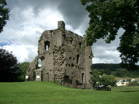
There had been warnings that the leader might set a cracking pace, yet the only evidence of his Army background was the occasional phrase “gather round chaps”. He also pointed out many aspects of the landscape we would have ignored; at first view, Castell Dinas appears to be a strangely shaped hill, yet this iron age fort near Pengenffordd is the highest castle in Wales and England. Later used by invading Normans, its green ramparts still dominate the Rhiangoll valley. Did its residents have to time to gaze as we did, or was their life in the midst of this beauty a constant fight for existence? For some, retreat to the Crannog on Llangorse Lake was necessary; this small man-made island supported a group of iron age dwellings in a perfect defensive position. Today you can visit the reconstructed site, and imagine its isolated community keeping watch across the dark waters.
Some of our group were keen to improve their fitness on the walk. There is a time and a place for Nordic poles; probably not when negotiating a narrow sheep track, with gorse bushes providing painful handholds. Steering clear of flailing sticks, we met a group of Welsh Mountain ponies. This party of expectant mums clustered under the ridge, enjoying the sunshine and looking remarkably sleek. Even when sandwich bags rustled they preserved a dignified and remote bearing, quite unlike their New Forest counterparts. Eventually we returned, at a steady downhill pace, to Bwlch where our leader invited us to “fall out on completion”, leaving behind a landscape unchanged for generations.
Day two, walking along a towpath under the same clear sky, we were stalked by a low-flying heron, his trailing legs contrasting with his graceful flight. He stayed with us for several miles, occasionally concealing himself in reeds only to re-emerge as we approached. His every movement was greeted with a sibilant “ssshhhh” from the lead walkers, who immediately stopped in their tracks. Those at the rear, if not paying attention, stumbled into each other while attempting to stay on the narrow path. Eventually he glided down to the Usk; his lunchtime approached and he had fulfilled his Welsh tourism duties for the morning. Sheltered by trees tinged red and green in early spring, frequently crossed by small stone bridges, the canal merged into the landscape, adding to its charm.
This walk was based around the industrial heritage of the area. The Monmouthshire and Brecon canal had been built in the 1790’s, when Wales led the world in iron production. In season luxury narrowboats have replaced coal barges, yet some traces of past industry are still obvious. The row of limekilns at Talybont on Usk, now overgrown, would have smoked night and day. Navvies and bargees bought their ale in the many canal-side inns; now much appreciated by holidaymakers. The canal had impacted on the area in other ways; the Act of Parliament authorising its construction had also permitted the building of tramroads, essential links between manufacturing areas and their expanding markets; nowadays a valuable tourist resource.
After several miles our leader swung left over a steep humpbacked bridge and we joined the Brinore Tramroad. Built in 1815 it carried limestone, iron and coal to the canal. The shouts of the hauliers, screeching of cast-iron wheels on the track, and warnings as loaded trams rattled downhill were long gone, and we steadily climbed uphill accompanied by birdsong, with branches creaking as a gentle breeze soughed through trees. Only underfoot did the tramroad betray its previous existence, as a line of stone sleeper blocks appeared for a while, before resettling beneath moss and bracken, defeated by nature.
Puffing a little we reached a junction. Below us, Talybont reservoir was bordered by dense conifers. We had walked its length, leaving behind Aber village near the dam, and could just see the marshy delta of the Caerfanell River before it expanded into the reservoir. The valley was flooded in the 1930s, to provide Newport with water. Two hundred residents had to leave and the loss of the valley farms made their upland fields redundant, hence the influx of forestry.
Suddenly a cloud blocked the sun, the wind dropped and a single ripple on the dark water took on a sinister aspect. I waited for our leader to reveal some local legend, based on the drowned valley.
“I think we’ll have lunch here” she decided, and as we sipped hot coffee the sun came out, blue skies reflected on the water’s surface, and the birds began to sing again.
Below us a broad path was the only reminder of the Brecon and Merthyr Tydfil Junction Railway. Now part of the Taff Trail, sheltered from wind and sun, this peaceful track is a haven for walkers and cyclists, yet in its heyday it was known as “The Breakneck and Murder Railway”. In 1878, four hundred tons of locomotive and trucks lost control on the steep gradient into Talybont. Travelling at six times the regulation speed, the train careered off the rails near the White Hart Inn, killing four men and seriously injuring three others.
What did we learn in two days? That we were privileged to be able to enjoy the landscape, unlike our ancestors who had perforce concentrated on survival, from the iron age to the industrial revolution. Above all, our walks demonstrated the power of the natural world to outlive human endeavour. In this beautiful area of South Wales nature has won; both tragedies and triumphs of former ages lie hidden in the midst of idyllic rural countryside.
© Jane Anderson January 2014
For more information about activities and accommodation see the National Park website www.breconbeacons.org/
This year the Crickhowell Walking Festival runs from 1 to 9 March 2014. www.crickhowellfestival.com